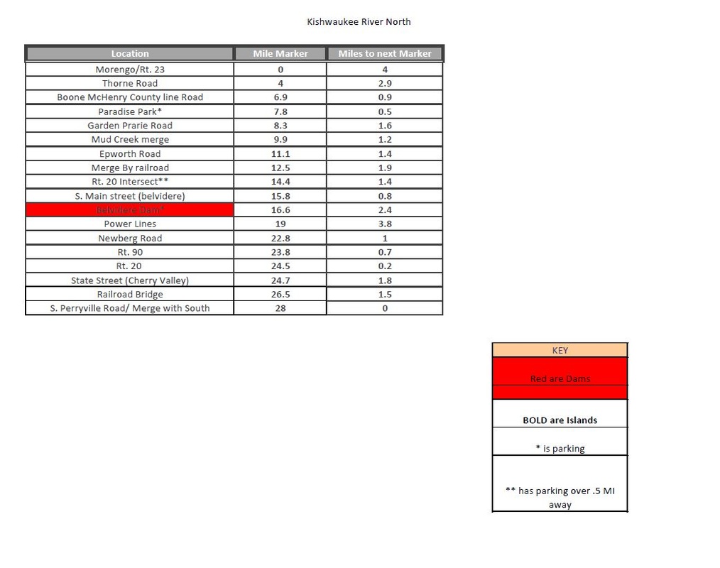
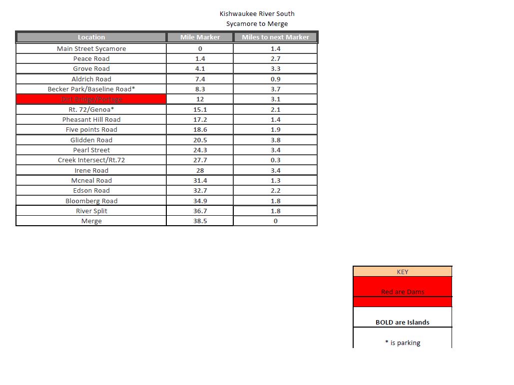
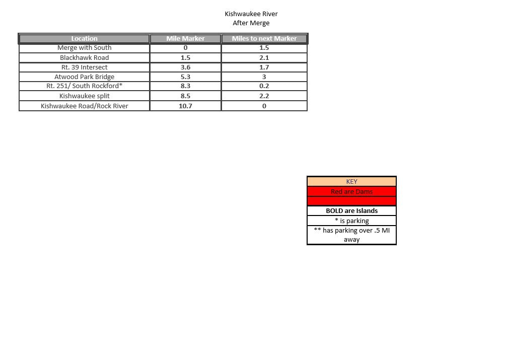
Kishwaukee River
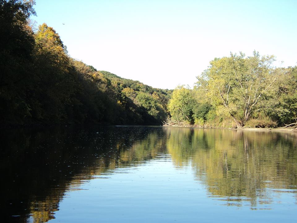
The Kishwaukee River features a gradient between 3-6 feet per mile. The river flows between 2 and 6 MPH, spiking in spots with an average of 2.5 MPH. It has separate north and south branches, which merge in Blackhawk Springs Forest Preserve (by Rt. 39). The northern branch passes through Belvidere, heading west to the Rock River. The southern branch begins in Sycamore area.
The Kishwaukee river ends when it merges into the Rock river, south of Rockford.
The Kishwaukee is often too small for power boats, but well suited for canoes and kayaks. It greatly depends on amount of deadfall and water level. Please check this river closely before attempting a trip. High water is especially dangerous through the Cherry Valley area.
|
|
| ||||||
| kishwaukee_river_put_ins.gpx |
Trip Reports
Dams and Portaging
Camp Epworth
Garden Prairie (Epworth Rd), IL
Downstream (west) of Garden Prairie Road bridge.
Low Head dam with 3 upright concrete pillars (old bridge supports?)
Belivdere Park Dam
Belvidere, IL
Good sized dam with lots of sharp rocks. Do not attempt to shoot this dam. Portage to the left/south side.
Garden Prairie (Epworth Rd), IL
Downstream (west) of Garden Prairie Road bridge.
Low Head dam with 3 upright concrete pillars (old bridge supports?)
Belivdere Park Dam
Belvidere, IL
Good sized dam with lots of sharp rocks. Do not attempt to shoot this dam. Portage to the left/south side.
