Pecatonica River
The Pecatonica river flows down from Wisconsin, through Freeport, and then into the Rock River. It is a very remote river, primarily surrounded by woods and farmland. There are few towns neighboring the river.
The Pecatonica river flows about 2 MPH, with a gradient of less than 1 foot per mile.
The Pecatonica river flows about 2 MPH, with a gradient of less than 1 foot per mile.
| pecatonica.pdf |
|
| ||||
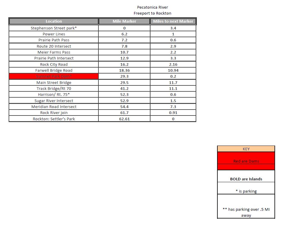
Dams and Portaging
Sumner Park Dam
Pecatonica River - Pecatonica , IL
Small, broken down dam, portage on the north/left side of river.
Brown's Mill
Pecatonica River - Freeport/Ridott, IL
GPS coords are off on this one, if anyone can provide exact details please let me know!!! Small broken dam at Brown's Mill, about 10 miles downstream of Hancock Ave Boat Ramp.
Blanchardville Dam East Branch
Pecatonica River - Blanchardville, WI
Argyle Power Pland Dam
Pecatonica River - Argyle, WI
Right past the 81 bridge.
Brown's Mill Dam
Pecatonica River - Freeport, IL
There is a small broken dam at Brown's Mill, about 10 miles downstream from Freeport that you 'might' have to portage around.
The LEFT side of this broken dam is lower.
