Upper Iowa River
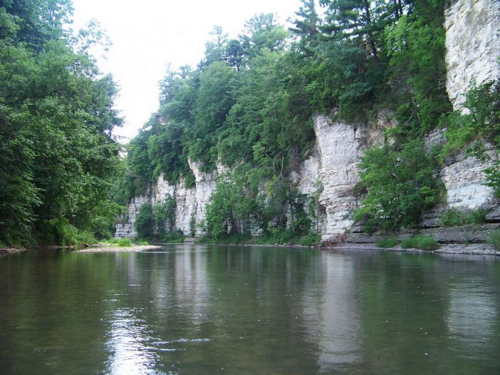
The Upper Iowa River is perhaps the most widely-recognized river in Iowa and one of the first in the nation to be nominated as a national Wild and Scenic River in the 1960s. Thanks largely to private landowners and organizations that own and care for it, the river corridor has retained its scenic and natural character and become a premier recreational river. Paddlers will share this river with local families, anglers, bird enthusiasts, campers, hikers and the wildlife that call this diverse corridor home. The river originates in LeRoy, Minnesota before meandering 136 miles to the Mississippi River near New Albin, Iowa. The river and corridor change along its length, going from a narrow and winding savanna river to a wider and more dynamic river flanked by dramatic vertical limestone palisades and forested bluffs.
|
|
Flood Stage: 14'
Action Stage: 8' Scrap Stage: Under 5' |
|
|
Flood Stage: 14'
Action Stage: 11' Scrape Stage: Under 2' |
|
|
Flood Stage: 12'
Action stage: 9' Scrape stage: under 2' |
Dams and Portaging |
Flood Stage: 14'
Action Stage: 11' Scrape Stage: 2' |
Upper Dam: Take out on river left and follow path
Lower Dam: Take out on river right and go up and over the hump
Lower Dam: Take out on river right and go up and over the hump
