Illinois Paddle
  • Home
  • About
    • Contact
    • Comment Policy
  • Blog
    • Gear
    • Journal
    • News
    • Tips
  • Resources
  • River Trips
    • Illinois Rivers >
      • Des Plaines
      • DuPage River
      • Fox River
      • Illinois River
      • Iroquois River
      • Kankakee River
      • Kishwaukee River
      • Little Vermilion River
      • Mazon River
      • Pecatonica River
      • Rock River
      • Vermilion River
    • Indiana Rivers >
      • White River
      • Sugar Creek
    • Iowa Rivers >
      • Upper Iowa River
      • Turkey River
    • Michigan Rivers >
      • Grand River
      • Pictured Rocks
    • Minnesota Rivers >
      • Boundary Waters
    • Missouri Rivers >
      • Current River (Ozarks)
    • Wisconsin Rivers >
      • Fox River WI
      • Sheboygan River
      • Wisconsin River

Wisconsin River

The Wisconsin River is a large river that flows through the Wisconsin Dells before cutting west by Madison. Spanning 430 miles, it is the longest river in the state of Wisconsin. It's also a large tributary to the Mississippi. There are two main sections suitable for paddling: the upper Dells section, and the southern/western.

Trip Reports:
Dells trip 1
Dells Trips 2 and 3
Western Branch: Prairie du Sac to Mississippi​

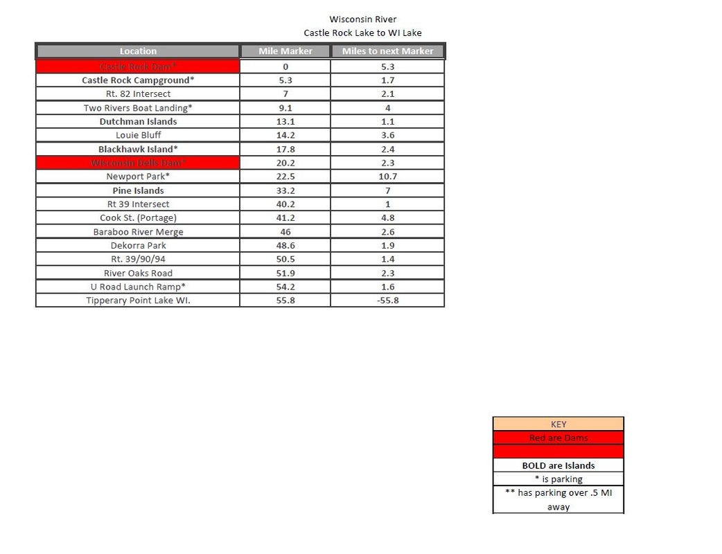
Wisconsin Dells Branch

wisconsin_river_castle_rock_to_lake_wi_1.pdf
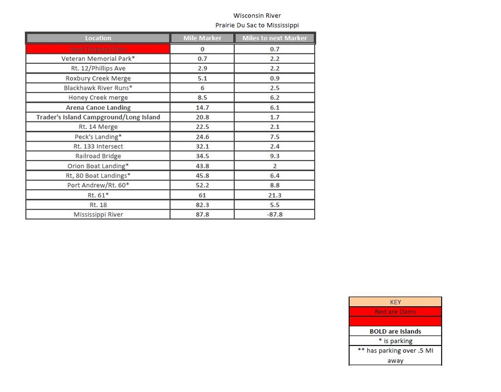
File Size: 192 kb
File Type: pdf
Download File

USGS Water-data graph for site 05404000
USGS Water-data graph for site 05407000
Picture

Western Branch

wisconsin_river_prairie_du_sac_to_missippi.pdf
File Size: 188 kb
File Type: pdf
Download File

Picture
wisconsin_river_put_ins.gpx
File Size: 3 kb
File Type: gpx
Download File

Dams and Portaging
Castle Rock Dam
Wisconsin Dells:
Portage on river left
​Prairie Du Sac
All maps and information are for research purposes only, and are not guaranteed to be 100% accurate. Do your own research before embarking.