Rock River
The Rock River flows into the mississippi. It is a deeper and wider river, without as much current.
It flows about 1 MPH, occasionally 2 in tighter stretches, witha gradient of just 1 foot per mile.
Headwinds can hinder paddling progress.
Standard Trips:
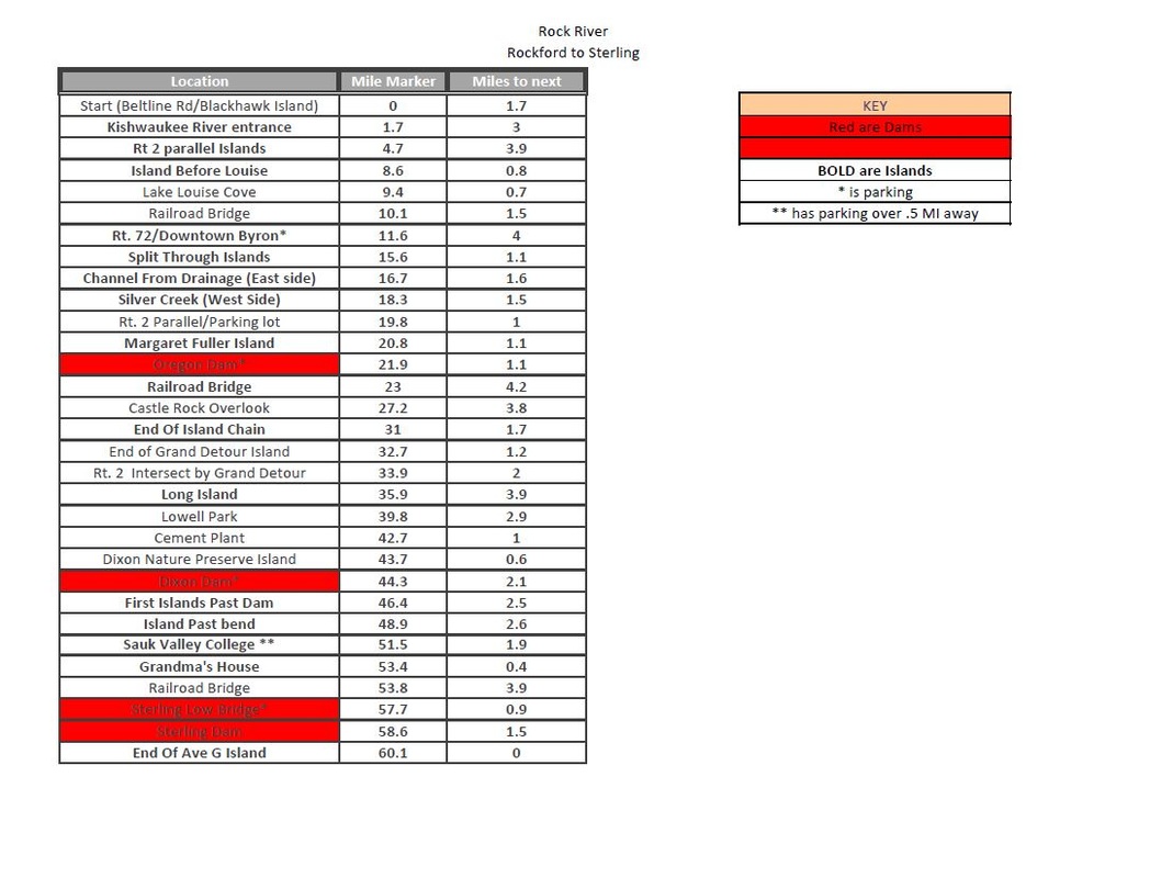
Rockford to Oregon: 22 miles
Oregon to Dixon: 30 miles
It flows about 1 MPH, occasionally 2 in tighter stretches, witha gradient of just 1 foot per mile.
Headwinds can hinder paddling progress.
Standard Trips:
Rockford to Oregon: 22 miles
Oregon to Dixon: 30 miles
Trip Reports
|
| ||||
Dams and Portaging
Rockton Dam – Rockton, IL
Fordham Dam – Rockford, IL
Oregon Dam – Oregon, IL
Portage is on river right. Marked path for take out and put in. About a 400 foot walk.
DIxon Dam – Dixon, IL
Sinnissippi Dam – Sterling/Rock Falls, IL
Milan Steel Dam – Milan, IL
Sears Dam – Rock Island, IL
Fordham Dam – Rockford, IL
Oregon Dam – Oregon, IL
Portage is on river right. Marked path for take out and put in. About a 400 foot walk.
DIxon Dam – Dixon, IL
Sinnissippi Dam – Sterling/Rock Falls, IL
Milan Steel Dam – Milan, IL
Sears Dam – Rock Island, IL
